
Urban forest management action plan and strategy development, Land use and Land cover mapping is a project being implemented by Kasese Municipality with Financial support from Expertise France. It is a joint partnership between Kasese Municipality, Expertise France under the Covenant of Mayors in Sub-Saharan Africa (CoM SSA) initiative to make cities in Sub Saharan Africa resilient in the fight against climate change and ensuring access to clean energy.
The project has a number of activities and among them has been equipping Municipality Technical staff especially those in charge of environment, planning and engineering with skills in QGIS (Quantum Geographic Information System).
The five days training was conducted by KENRO consults a company that was hired to implement the project with technical support of GEDA Uganda that supervises the project implementation.
A number of modules were covered including but not limited to General Introduction to GIS AND GEOSPATIAL DATA, Essential workflows, Spatial Analysis, Land use, land cover mapping, Map production among others.
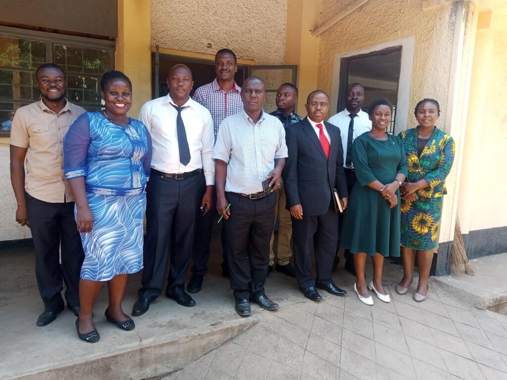
In his remarks while officiating at the opening of the 5 days training, the Town Clerk Kasese Municipality encouraged the participants to embrace the training and translate the skills into practice as they go about their official assignments. He added that he trusted the team that was undergoing the training and that he was confident of the results.
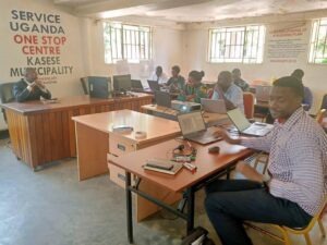
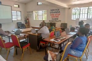
Above: Training sessions
Speaking at the closure of the training Ms.Medius Bihunirwa from GEDA Uganda applauded the team that had trained and the trainer Mr. Abubaker from KENRO. She encouraged the senior team from the Municipality not to stop at the training but continuously find time and practice as this was a practical subject that needed continuous practice. The participants agreed to form a whatsapp group that would act as a link between them and the trainer. Further discussions will be held to complete the course as the 5 days were not enough to cover all the content.
At the end of the training all participants were able to create different maps using the skills acquired.
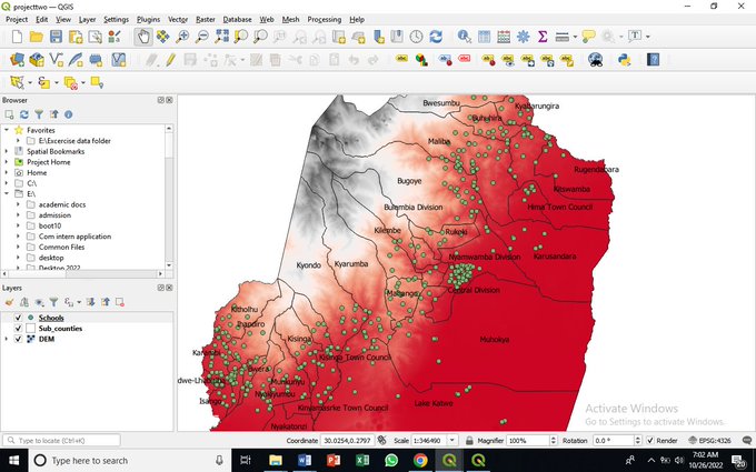
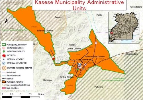
Some of the sample maps during and after the training.
Comments